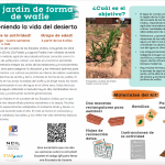
Un jardín de forma de wafle
La gente indígena del suroeste de los Estados Unidos, incluyendo los Diné (Navajo), A:shiwi (Zuni), Zia Pueblo y Laguna Pueblo, han utilizado durante generaciones un método agrícola de probada eficacia conocido como Un jardín de forma de wafle para cultivar con éxito en el entorno semiárido. Esta técnica centenaria integra los ciclos de las…
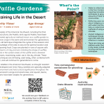
Waffle Garden
Indigenous peoples of the American Southwest, including the Diné (Navajo), A:shiwi (Zuni), Zia Pueblo, and Laguna Pueblo, have been using a time-tested agricultural method known as a waffle garden to successfully grow crops in the semi-arid environment for generations. This centuries-old technique integrates the cycles of the seasons and…

Sé un héroe del ecosistema del agua
Combate la contaminación del agua jugando en equipo y sal de casa para Buscar un Polinizador
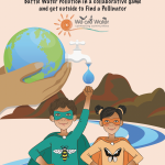
Be a Water Ecosystem Hero
Work with a partner to protect a river from water pollution in a collaborative board game. Search for evidence of pollinators in your backyard and draw what you find. And learn about the connections between water, pollution and pollinators.
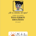
¡Sé un detective del agua!
Ser un detective del agua significa ser un buen observador. Los y las detectives del agua se fijan no solo en cómo el agua cambia la superficie de nuestro planeta, pero también en cómo el agua soporta la vida terrestre y es en turno afectada a su por los seres vivos que llaman a la Tierra su hogar.
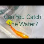
Can You Catch The Water?
Students construct three-dimensional models of water catchment basins using everyday objects to form hills, mountains, valleys and water sources. They experiment to see where rain travels and collects, and survey water pathways to see how they can be altered by natural and human activities. Students discuss how engineers design structures that…
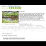
All About Water!
Students learn about the differences between surface and ground water as well as the differences between streams, rivers and lakes. Then, they learn about dissolved organic matter (DOM) and the role it plays in identifying drinking water sources. Then students are introduced to conventional drinking water treatment processes by developing and…
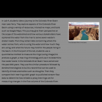
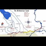
Sharing a River - The Colorado River Story
In Lab 4, students take a journey to the Colorado River Basin near Lees Ferry. They explore aspects of the Colorado River Basin using a variety of resources, interactive maps, and tools such as Google Maps. This journey give them perspective on the scope of the watershed and how various stakeholders have siphoned the water from the river to serve…
The Colorado River Water Story
The Colorado River watershed has always been a subject of great interest and concern. It provides agricultural irrigation and drinking water to farms and cities in seven southwestern states. The intention of this exercise is to be a southwestern regional perspective of a changing climate. You’ll be graphing snowpack in the Colorado Rocky Mountains…

Drought in the Colorado River Basin
This application was developed by the U.S. Geological Survey and the Bureau of Reclamation in support of the Department of the Interior’s Open Water Data Initiative (OWDI). This visualization is part of a multi-agency effort to showcase the usefulness of open data (i.e., data provided in a discoverable, sharable, and machine-readable…
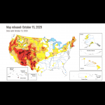
U.S. Drought Monitor
This is a real-time map of current drought conditions in the US, which can be zoomed to the state level, with access to many more resources at that level. Some of these include the National Drought Regional Summaries and animations of historical data.
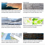
National Integrated Drought Information System: Data, Maps and Tools
This is a extensive collection of maps, data, and tools that students can use to research drought and its impacts on agriculture, wildfires, water supply, vegetation, soil moisture, temperature and precipitation.
Tracking Water Using NASA Satellite Data
Using real data from NASA's GRACE satellites, students will track water mass changes in the U.S., data that measures changes in ice, surface and especially groundwater. The background information includes an animated video about where water exists and how it moves around Earth, as well as short video clips to introduce the GRACE mission and…
Colorado River water supply
This activity addresses climate change impacts that affect all states that are part of the Colorado River Basin and are dependent on its water. Students examine available data, the possible consequences of changes to various user groups, and suggest solutions to adapt to these changes. Activity takes about one-two class periods and homework…
Be a Water Detective
Use pH strips to test the pH of substances in your home and in your environment. Use your pH strips for an art project and learn how the ancient basketmakers weaved baskets.