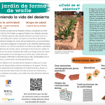
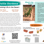
Un jardín de forma de wafle
La gente indígena del suroeste de los Estados Unidos, incluyendo los Diné (Navajo), A:shiwi (Zuni), Zia Pueblo y Laguna Pueblo, han utilizado durante generaciones un método agrícola de probada eficacia conocido como Un jardín de forma de wafle para cultivar con éxito en el entorno semiárido. Esta técnica centenaria integra los ciclos de las…
Waffle Garden
Indigenous peoples of the American Southwest, including the Diné (Navajo), A:shiwi (Zuni), Zia Pueblo, and Laguna Pueblo, have been using a time-tested agricultural method known as a waffle garden to successfully grow crops in the semi-arid environment for generations. This centuries-old technique integrates the cycles of the seasons and…

Stop-Motion Animation Workshop
Create a stop-motion animation video! Learn how to create a short (<1 minute) stop-motion animation of a story. This workshop is designed to be completed in two days or two sessions. Each portion is about 1.5 – 2 hours long. Workshop created by Dr. Emily Fairfax from California State University Channel Islands.

Sé un héroe del ecosistema del agua
Combate la contaminación del agua jugando en equipo y sal de casa para Buscar un Polinizador
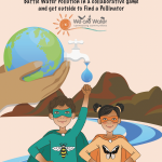
Be a Water Ecosystem Hero
Work with a partner to protect a river from water pollution in a collaborative board game. Search for evidence of pollinators in your backyard and draw what you find. And learn about the connections between water, pollution and pollinators.
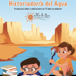
Sé un/a Historiador/a del Agua
Toda persona tiene una historia que contar. Registrar las historias de tus familiares y amigos y las personas de tu comunidad es fundamental para conocer la historia de tu pueblo. Esta actividad le enseña a ser un/a buen/a entrevistador/a.
Be a Water Historian
Everyone has a story to tell. Recording stories from your family, friends, and people in your community is an important part of understanding history in your town. In this activity, you will learn how to be a good interviewer so that you can help preserve amazing stories from your community!
¡Sé un detective del agua!
Ser un detective del agua significa ser un buen observador. Los y las detectives del agua se fijan no solo en cómo el agua cambia la superficie de nuestro planeta, pero también en cómo el agua soporta la vida terrestre y es en turno afectada a su por los seres vivos que llaman a la Tierra su hogar.
We Are Water Art Museum
Submit your water-themed craft, art or photos to be showcased in the We Are Water Art Museum. Select the best display category.
History of Development of the Colorado River Basin
In this video, Dr. Paul Lander from the University of Colorado Boulder gives a lecture on the history of two important dams: Hoover and Glen Canyon. This is part of the Water in the Western US lecture series.

Review of the Water Cycle (with a focus on the Western US)
In this video Dr. Anne Gold and Eric Gordon give a brief review on the different processes involved in the water cycle, specifically in the Western United States.
All About Water!
Students learn about the differences between surface and ground water as well as the differences between streams, rivers and lakes. Then, they learn about dissolved organic matter (DOM) and the role it plays in identifying drinking water sources. Then students are introduced to conventional drinking water treatment processes by developing and…
The Colorado River Water Story
The Colorado River watershed has always been a subject of great interest and concern. It provides agricultural irrigation and drinking water to farms and cities in seven southwestern states. The intention of this exercise is to be a southwestern regional perspective of a changing climate. You’ll be graphing snowpack in the Colorado Rocky Mountains…
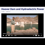
Hoover Dam and Hydroelectric Power
Since its completion, Hoover Dam has wowed visitors with its sheer massiveness and its ability to create and hold back a reservoir that covers nearly 650 square kilometers (250 square miles). Yet, perhaps even more impressive is the dam's ability to harness the potential energy stored in the reservoir and convert it to electricity. In this video…
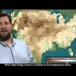
Baking the Bread Basket: Drought in the Heartland
From scorching July heat to well-below-average summer rainfall, NOAA’s Deke Arndt, Chief of the Climate Monitoring Branch at the National Climatic Data Center, recaps summer climate conditions across the United States. Running time: 3:02
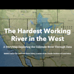
The Hardest Working River in the West
This is a StoryMap on the Colorado River. The story map details the history of the Colorado River, water resources, river management, and tools for managing in the future.

Drought Data and Projections
This resource includes 3 videos that are animations of drought data. The first is an animation of the US Drought Monitor drought index snapshots from 2010-2018. The second is an animation of global drought data from satellites from 2013-2018. The third is an animation of drought projections for the US from 1950-2095.
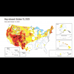
U.S. Drought Monitor
This is a real-time map of current drought conditions in the US, which can be zoomed to the state level, with access to many more resources at that level. Some of these include the National Drought Regional Summaries and animations of historical data.
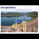
Drought Basics
This PBS Learning Media activity addresses drought basics, including its causes and impacts and ways to assess it, by using media from NOAA and NASA. It defines the types of drought, the impacts, monitoring, and responses to drought. Use this resource to stimulate thinking and questions on the complexity of drought and to identify some variables…

SciJinks: Precipitation Simulator
A computer simulator that allows students to adjust the air temperature and dew point to see what type of precipitation would fall to the ground.
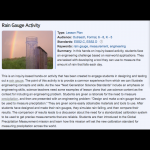
Rain Gauge Activity
In this hands-on inquiry-based activity, students face an engineering challenge based on real-world applications. They are tasked with developing a tool they can use to measure the amount of rain that falls each day. This is more of a mini unit than a stand alone activity. This activity takes one to three 60 min class periods. Additional…
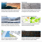
National Integrated Drought Information System: Data, Maps and Tools
This is a extensive collection of maps, data, and tools that students can use to research drought and its impacts on agriculture, wildfires, water supply, vegetation, soil moisture, temperature and precipitation.
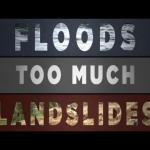
Too Much, Too Little
This video describes the joint NASA-JAXA GPM (Global Precipitation Measurement) satellite mission and why it is necessary for monitoring precipitation around the Earth. It also discusses the science around issues of having too much or too little precipitation such as landslides and drought. It emphasizes the need for data to fill in gaps, and why…
Assessing Drought in the United States
This easy-to-understand video animation describes drought and explains the different categories of drought used by the drought monitor. It discusses the effects of and contributions to drought, what the implications of the different drought levels are, and puts the drought maps into context to understand how the impacts vary geographically (e.g.…
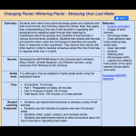
Changing Planet: Withering Crops
This video examines what will happen to crops as Earth's temperature rises and soils dry out because of changing climate. Video length: 5:50 min.