
SciJinks: Precipitation Simulator
A computer simulator that allows students to adjust the air temperature and dew point to see what type of precipitation would fall to the ground.
Learn More
Rain Gauge Activity
In this hands-on inquiry-based activity, students face an engineering challenge based on real-world applications. They are tasked with developing a tool they can use to measure the amount of rain that falls each day. This is more of a mini unit than a stand alone activity.
Learn More
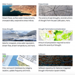
National Integrated Drought Information System: Data, Maps and Tools
This is a extensive collection of maps, data, and tools that students can use to research drought and its impacts on agriculture, wildfires, water supply, vegetation, soil moisture, temperature and precipitation.
Learn More
Too Much, Too Little
This video describes the joint NASA-JAXA GPM (Global Precipitation Measurement) satellite mission and why it is necessary for monitoring precipitation around the Earth. It also discusses the science around issues of having too much or too little precipitation such as landslides and drought. It emphasizes the need for data to fill in gaps, and why data and being able to predict natural disasters is so valuable.
Learn More
Assessing Drought in the United States
This easy-to-understand video animation describes drought and explains the different categories of drought used by the drought monitor.
Learn More

Evaporation Investigation
Students observe the process of evaporation, make comparisons about the process, then construct a diagram and use it to describe the process of evaporation.
Learn More
Changing Planet: Withering Crops
This video examines what will happen to crops as Earth's temperature rises and soils dry out because of changing climate.
Learn More
What-a-cycle
In this activity, students act as water molecules and travel through parts of the water cycle (ocean, atmosphere, clouds, glaciers, snow, rivers, lakes, ground, aquifer). Students use a diagram of the hydrologic cycle to draw the pathway they traveled.
Learn More
The Water Cycle: Now You See It, Now You Don't
This lesson is an instructor demonstration that focuses specifically on two aspects of the water cycle: evaporation and condensation. This is a well described instructor led demonstration for introducing and exploring the water cycle.
Learn More

Tracking Water Using NASA Satellite Data
Using real data from NASA's GRACE satellites, students will track water mass changes in the U.S., data that measures changes in ice, surface and especially groundwater.
Learn More