Water Storage and Delivery Infrastructure
In this video, Dr. Anne Gold from CU Boulder explains the importance of infrastructure for the storage and delivery of water in the dry Western United States. Learn all about the history of this infrastructure and how it has helped societies in the Western United States. This video is part of the Water in the Western US lecture series.

Native American Tribes and Water
In this video, Julie Nania from the High Country Conservation Advocates discusses tribal water uses in the Western United States. Learn more about the historical cultural relationship between Native American tribes and natural water. This video is part of the Water in the Western US lecture series.

History and Development of Water in the West
Dr. Paul Lander from the University of Colorado Boulder gives a lecture on the history of water resources in the Western United States, from the pre-colonial time period onward. This video is part of the Water in the Western US lecture series.

Review of the Water Cycle (with a focus on the Western US)
In this video Dr. Anne Gold and Eric Gordon give a brief review on the different processes involved in the water cycle, specifically in the Western United States.

Geography of the West
Eric Gordon and Dr. Anne Gold give an overview on the geographic features that define the Western United States, both physical and political.

Important Things to Know About the Course
Eric Gordon and Dr. Anne Gold give an overview on the basics of the various subjects covered in the Water in the Western US lecture series.

Why Study Water in the West?
This video serves as an introduction to the Water in the Western US lecture series. The instructors Dr. Anne Gold and Eric Gordon explain the importance of learning about water in the Western United States.

Rain Gauge Activity
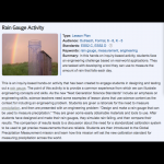
In this hands-on inquiry-based activity, students face an engineering challenge based on real-world applications. They are tasked with developing a tool they can use to measure the amount of rain that falls each day. This is more of a mini unit than a stand alone activity. This activity takes one to three 60 min class periods. Additional…

Assessing Drought in the United States
This easy-to-understand video animation describes drought and explains the different categories of drought used by the drought monitor. It discusses the effects of and contributions to drought, what the implications of the different drought levels are, and puts the drought maps into context to understand how the impacts vary geographically (e.g.…

ESRI Drought Tracker
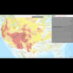
Using US Drought Monitor data and its classification system, this interactive tool tracks drought in the continental US by county, from 2000 to the present.
Pagination
- Previous page
- Page 2
